- Home (Map)
- |
- |
- |
- |
- About
- |
- Notes to User

When a station reported heavy rain or snow, a symbol would be shown on the map. Symbols of different colours are used to indicate whether the observation was reported in the most recent synoptic hour or reported 6, 12, or 18 hours earlier.
 Latest reports Latest reports |
 About 6 hours earlier About 6 hours earlier |
| About 12 hours earlier |
| About 18 hours earlier |
Clicking on a raining icon will open a window showing the rainfall/snowfall in 24 hours. Information of the reporting station including location in latitude and longitude units, height and the Member that owns the station will also be displayed.
Definition of Heavy Rain/Snow
Rainfall or snowfall greater than or equal to 50 mm in the past 24 hours.
Source of data
The weather observations are extracted from Members' SYNOP reports submitted to WMO through the WMO Information System (WIS).
When a station reported gale, a symbol would be shown on the map. Symbols of different colours are used to indicate whether the observation was reported in the past 3 hours, past 6-9 hours, past 12-15 hours, or past 18-21 hours.
 Past 3 hours Past 3 hours |
 Past 6-9 hours Past 6-9 hours |
| Past 12-15 hours |
| Past 18-21 hours |
Clicking on a gale icon will open a window showing wind speed and direction of the report. Information of the reporting station including location in latitude and longitude unites, height and the Member that owns the station will also be displayed.
Definition of Gale
Wind speed greater than or equal to 34 knots or 18 m/s.
Source of data
The data are based on weather observations extracted from SYNOP reports from land stations and ships of WMO members. Only limited data quality checks are applied, care must be taken in interpreting or using the gale data. For conversion between knots and m/s, the formula 1 m/s = 1.94 knots is employed.
Please note that the altitude of land stations would affect the observed wind speed. The altitude of the station is the reference level to which barometric pressure reports at the station refer.
When a station reported thunderstorm, a symbol would be shown on the world map on the front page. Symbols of different shapes and colours are used to indicate whether the observation was reported in the past 3 hours, past 6-9 hours, past 12-15 hours, or past 18-21 hours.
 Past 3 hours Past 3 hours |
 Past 6-9 hours Past 6-9 hours |
| Past 12-15 hours |
| Past 18-21 hours |
On the map, lightning icons are used to indicate the location of thunderstorm occurrence. Different types of thunderstorms are indicated by different icons:
| Types of thunderstorm | Symbol |
|---|---|
| slight or moderate thunderstorm | 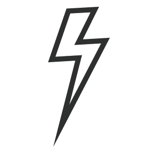 |
| heavy thunderstorm | 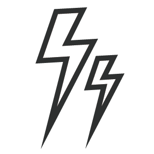 |
| thunderstorm with hail |  |
| thunderstorm with dust-storm or sand-storm | 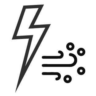 |
| heavy thunderstorm with hail | 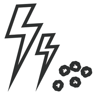 |
Clicking on a thunderstorm icon will open a window showing the type of thunderstorm of the report. Information of the reporting station including location in latitude and longitude unites, height and the Member that owns the station will also be displayed.
Source of data
The weather observations are extracted from Members' SYNOP reports submitted to WMO through the WMO WIS.
When a station reported fog, a symbol would be shown on the world map on the front page. Symbols of different colours are used to indicate whether the observation was reported in the past 3 hours, past 6-9 hours, past 12-15 hours, or past 18-21 hours.
 Past 3 hours Past 3 hours |
 Past 6-9 hours Past 6-9 hours |
| Past 12-15 hours |
| Past 18-21 hours |
Clicking on a fog icon will open a window showing the fog report and the visibility if available. Information of the reporting station including location in latitude and longitude unites, height and the Member that owns the station will also be displayed.
Source of data
The weather observations are extracted from Members' SYNOP reports submitted to WMO through the WMO WIS.